It is one of the four most important cycle routes in Italy and the only one in the South.
It winds for 500 kilometers in the territory of three regions, Campania, Basilicata and Puglia. And it certainly owes its extraordinary charm to the scenic beauty and naturalistic value of the territories it crosses, so much so that it is defined as a "greenway", but above all to the fact that it follows the route of the Apulian Aqueduct, the longest in Europe. It begins right in Irpinia, in Caposele, in the Picentini Mountains Regional Park, where the sources of the Sele river are located, whose water has quenched Puglia's thirst since the beginning of the twentieth century. There, in Salento, the large pipeline concludes its journey, feeding the scenic Leuca waterfall, directly on the Adriatic.
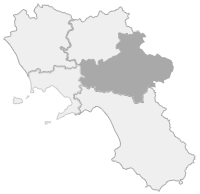
The stretch of the cycle route included in the Campania region, approximately 40 kilometers long, is currently entirely in Alta Irpinia, although extensions are being studied to accompany the long course of the Sele river up to Cilento, where it reaches the sea. The cycling route therefore starts from Caposele, from the beginning of the historic pipeline built between 1906 and 1939. There it is possible to see the original locks from 1909 which are still perfectly functional, as well as enjoying the many points of interest of the town on the slopes of Mount Paflagone, where the sources of the Sele are located.
From Caposele begins the climb to the Sella di Conza, the pass that separates the Campanian Apennines from the Lucanian Apennines, the Tyrrhenian Sele valley from the Adriatic valley of Ofanto, as well as the border between the provinces of Avellino and Salerno at the territory of Castelnuovo di Conza.
After passing the pass, the cycling route continues in the territory of Sant'Andrea di Conza, where it intersects with the Borbone Cycle Route which connects Bari and Naples. It then crosses the Ofanto river in Calitri and enters Basilicata, in the territory of Rapone, in the province of Potenza.


Comments powered by CComment