Sorrentine Peninsula and Coast of Amalfi offer numerous nature trails, the most famous of all is the Path of the Gods, then there is the Valle delle Ferriere between Scala and Amalfi and, for the most trained and technically prepared, there is the High way of the Lattari mountains (CAI 300), a path of about sixty kilometers that from Cava dei Tirreni reaches Punta della Campanella, the extreme point of the Sorrentine Peninsula.
A portion of this route crosses Mount Vico Alvano, a hill whose summit reaches 643 meters. Standing between the gulf of Naples and the gulf of Salerno, this area offers various possibilities for excursions.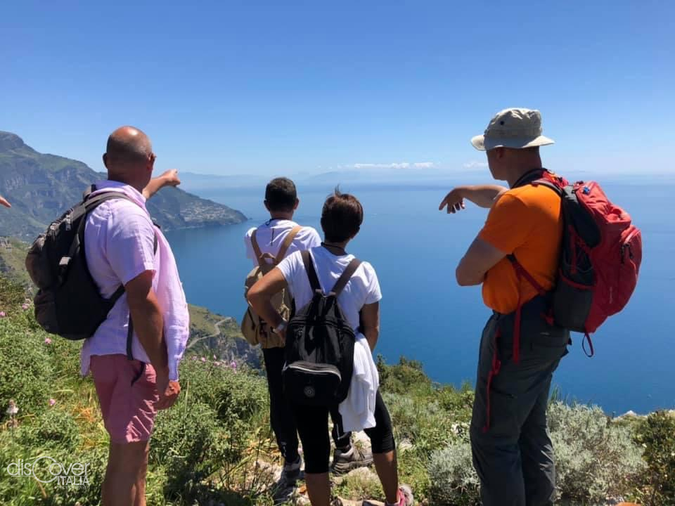
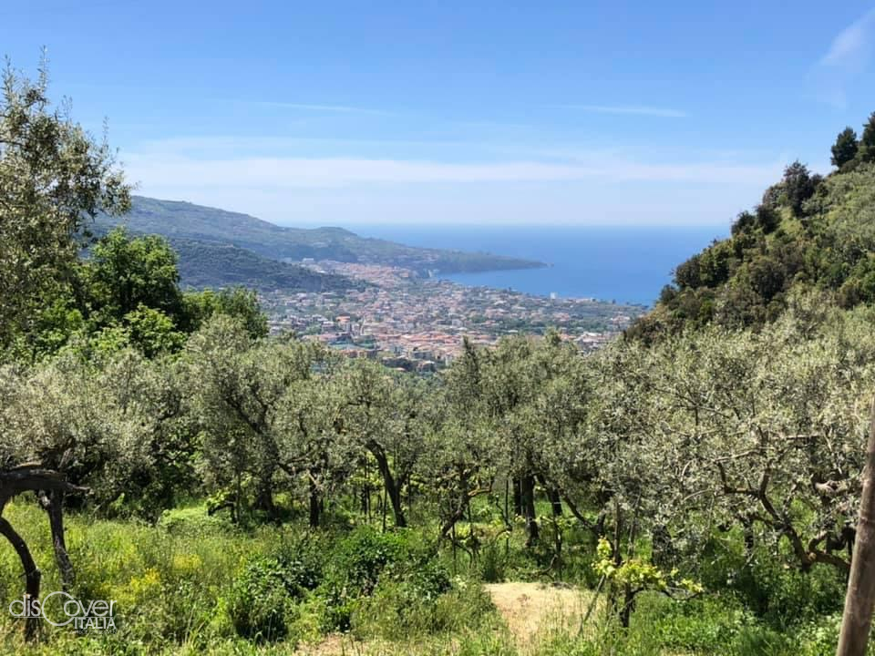
Taking as starting point the Colli di San Pietro (310m a.s.l.), a hamlet of Sorrento’s plain and walking east, there is the park of a villa that used to belong to the Colonna family, following the CAI trail signs (white paint lines and red) the climb towards Mount Vico Alvano begins, along bends alternating between south and north offering extraordinary views, first on the islets of Li Galli, then towards the Coast of Sorrento and its slopes planted with olive and citrus trees. Going further, the south bends overlook the bay of Tordigliano and the Amalfi state road 163, proceeding north in the distance you can see the islands of Ischia and Procida with the Flegrea area. At the edge of the path the typical Mediterranean scrub of gorse, holm oak, strawberry tree, myrtle, euphorbia, cistus. Higher up, the vegetation turns into garrigue, after the numerous fires that have hit the area; ferns cover the now less steep slope until reaching the saddle (613m a.s.l.) from which the path leading to the Cross (642m a.s.l.) branch off on the left and the main path (CAI 300) on which eventually continue.
 Up to here we have just over 2.6 kilometers, definitely worth reaching the Cross from which you can admire a breathtaking view: from the head of Sorrento to Vesuvius, from Naples to Mount Faito with its highest peak: Mount S.Micheal, also known as "Il Molare" and not "Monte Molare" as often read lately. At the foot of the Cross; the towns of Meta, Sorrento’s plain, Sant'Agnello and, to the west, overlooking the sea, the most luxurious hotels in Sorrento can be admired.
Back to the "saddle", one can decide to return to the starting point, walking back along the same path or, continue south-east, descending among the chestnut woods towards the area called "Cesine", here there are various panoramic points overlooking the coast below. After crossing the ridge, always following the CAI trail signs, you go up a bit to then go down towards the so-called Door of Arola, an ancient gate that separated the southern coast from the hilly hamlets of Vico Equense.
Once at the Door of Arola, it’s possible to go down to the left towards an area called Veterina and reach Arola, where one can catch the bus to Vico Equense or get off on Grottelle street in Meta and from there take the Circumvesuviana to Naples or the bus that leads to Sorrento.
From the Door of Arola, continuing uphill to the east going up to Mount Comune (875 m a.s.l.) and from here one can go down to Santa Maria al Castello (675m a.s.l.), and then continue on the Alta road towards Mount Faito or go down towards Positano.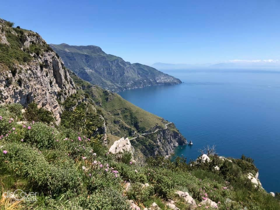
To better enjoy the excursion and above all, do it safely and get to know the historical, anthropic and naturalistic aspects of the area, it is recommended to rely on an expert hiking guide, alternatively it is important to consult a good map of the area, on the market there is the CAI Monti Lattari map or, alternatively, you can download the detailed map on the website www.giovis.com
Round trip from the hills of Saint Peter to the Cross of Mount Vico Alvano; duration: 3 hours, length: 6 km, difficulty: medium-easy
From the hills of Saint Peter to Arola; duration: 3 hours, length: 6 km, difficulty: medium-easy From the hills of Saint Peter to S. Mary at the Castel, through Mount Comune; duration 4 hours, length 8 km, medium difficulty
Good steps,
Luigi Esposito
Environmental Hiking Guide

Comments powered by CComment